
 1
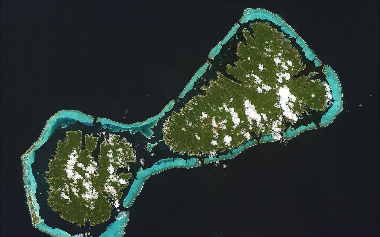
Raiatea is the second-largest of the Society Islands and, for many Polynesians, the most important. Its old name, Havai'i, echoes through the Pacific in the names of other islands far away, and its great marae at Taputapuatea, on the southeast coast, was once a centre of religious and political life for a wide region. Today the island feels unhurried. It has few sandy beaches, more mountains and rivers than its neighbours, and a working town, Uturoa, that serves the islands around it.
You arrive by air at Uturoa or by inter-island boat. From there a road circles the island, and Taputapuatea lies a long, scenic drive to the south and east.
Taputapuatea, a sacred landscape
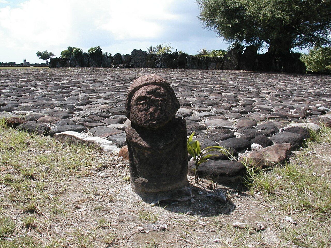
A marae is an open-air sacred place: a cleared court paved with stones, with a raised platform called an ahu at one end. Ceremonies, offerings, the investiture of chiefs and the departure of voyages all took place at marae. Taputapuatea is the largest and most famous complex in the islands, and in 2017 the wider cultural landscape around it, including land, lagoon and a pass through the reef, was added to the UNESCO World Heritage list.
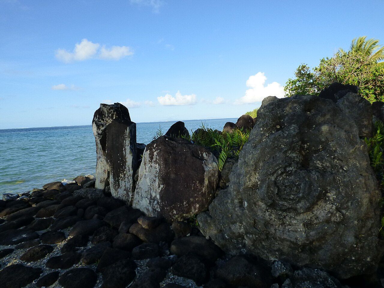
The site sits on a point of land by the lagoon. Long walls and platforms of basalt and coral slabs stand in the grass, some stones upright, others laid flat as paving. Facing the marae is a pass in the reef, and tradition holds that voyaging canoes left and returned through it. Standing on the shore, you can see why the place was chosen: open water, the reef line, and the ocean road beyond.
How to visit respectfully
Taputapuatea is sacred to many people today, not a ruin. A few rules matter more than any others:
- Stay off the stone platforms and paved courts. Walk on the grass and the marked paths, and do not climb or sit on walls or uprights.
- Do not move, stack or take stones, coral or plants, and do not leave objects of your own.
- Keep your voice low, and if people are gathered for a ceremony, watch from a distance or come back later.
- Ask before photographing people, and avoid posing in ways that treat the stones as a backdrop.
Children are welcome, but keep them close and explain beforehand that the stones are not for climbing. If you bring a picnic, eat it well away from the courts, and take every scrap of rubbish with you.
An information point near the site explains the layout. Go early in the day, when it is cooler and quieter, and take your time. The site is spread out, and the most rewarding way to see it is slowly, reading the shape of each court.
The voyaging island
Polynesian navigators crossed thousands of kilometres of open ocean in double-hulled canoes, steering by stars, swells, winds and birds. Raiatea held a central place in that world. Oral traditions across the Pacific remember it as a homeland and a place of departure, and stones from Taputapuatea were said to be carried to found new marae on distant islands.
One of those links you can still see. On Rarotonga, in the Cook Islands, there is a marae that also bears the name Taputapuatea, a reminder of how far the connection reached. In recent decades, voyaging canoes built in the old way have sailed back to Raiatea from across the Pacific, and gatherings at the marae have marked their arrival. To stand at Taputapuatea is to stand at one end of a very long sea road.
To stand at Taputapuatea is to stand at one end of a very long sea road.
Also on the menuVanilla island: Taha'a
The Faaroa river and the island's interior
Raiatea has something rare in these islands: a river you can travel up by boat. The Faaroa flows into a long, deep bay on the east coast, and the lower river winds between walls of dense green, with wild hibiscus, mape trees (Tahitian chestnut) and banana plants leaning over the water. Kayaking or paddling in the early morning is the gentlest way to see it; the water is still and birds call from the banks.
Inland, the island rises to Mount Temehani, a flat-topped plateau known for the tiare apetahi, a small white flower that grows wild nowhere else. It is fragile and protected. If you walk in the uplands, stay on established tracks, go with someone who knows the route, and never pick or touch the plants. The weather can close in quickly, and paths turn to slick mud after rain.
Eating on Raiatea
Uturoa's covered market is the place to start the day. Early in the morning you find stalls of fish laid out on ice, bunches of bananas, papayas, breadfruit and taro, bags of mape, and baked goods such as coconut bread and sweet buns. Ready-made poisson cru, packed in small tubs for lunch, is common; as with any raw fish, buy it early, keep it cool and eat it soon. The guide to poisson cru explains what to look for.
Around town, food comes from small snack bars, supermarkets and, in the evenings, food trucks. The cooking is the island mix you meet everywhere: grilled fish with rice, chow mein, steak with fries, and Polynesian dishes on special days. Read more about that blend in the guide to the Chinese-Tahitian kitchen. Outside Uturoa there are few places to eat, so if you are driving to Taputapuatea, pack water, fruit and something filling.
What to try
- Uru (breadfruit), roasted until the skin is black, then peeled and eaten hot with butter or coconut milk.
- Fresh lagoon fish, grilled simply with lime.
- Pain coco, a soft sweet bread made with coconut, from the market.
- Local fruit by the bag, explained in the fruit-stand guide.
Getting around and when to go
Uturoa itself is worth an unhurried hour: a harbour where inter-island boats unload, a few streets of shops and the market hall at its centre. It is the main town of the Leeward Islands, and on weekday mornings it is busy with people from the surrounding islands doing their errands.
A rental car or scooter gives you the freedom to reach the marae and the river at quiet times. The road around the island is narrow in places, with few services in the south. Distances are modest, but the drive takes longer than the map suggests because of the bays.
The cooler, drier season from about May to October brings clearer skies and more comfortable walking. The wetter months bring heavy showers and sometimes storms; check forecasts and local warnings before heading inland. Flights and boats between the islands are covered in the guide to ferries, flights and costs, and schedules shift with the season, so confirm them locally.