
 1
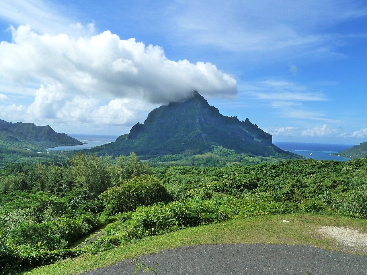
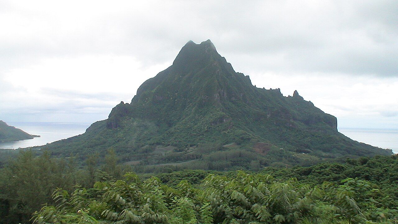
Look at a map of Moorea and the island resembles a rough heart with two notches bitten out of its northern edge. Those notches are Cook's Bay, to the east, and Opunohu Bay, to the west: long, deep inlets where the lagoon reaches far into the mountains and the water turns from turquoise to a darker, still green. Between them rises Mount Rotui, a ridge of about 900 metres that looks, from almost every angle, as if it had been cut out with a blade.
This corner of the island holds a great deal in a small space. You can drive the shore of both bays in an hour, climb a valley road to one of the best viewpoints in French Polynesia, walk among stone temple platforms under old chestnut trees and pass the fields that grow Moorea's famous small pineapples. Give it a full day, start early and keep lunch simple.
Cook's Bay: boats, mountains and a slow shoreline
Cook's Bay, also called Paopao Bay after the village at its head, is the busier of the two. The coast road follows its eastern shore past houses, small churches, a few shops and the boats that anchor in its sheltered water. At its head, the village of Paopao has the essentials: a grocery, a post office, a small market area where people sell fruit and fish when there is some to sell.
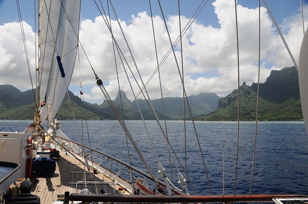
Despite its name, Captain Cook did not anchor here; he used Opunohu Bay on his visit. The name stuck all the same. Early morning is the time to see the bay well, before the trade wind ruffles the surface and while the mountains still sit sharp against the sky. Late afternoon is good too, when the light warms the cliffs of Mount Mouaroa, the peak locals sometimes call the shark's tooth.
Food here is informal. You find snack bars with a few plastic tables, grocery counters selling sandwiches on a split baguette, and fruit laid out on folding tables by the road. Ask for a casse-croûte, the island's all-purpose baguette sandwich, and a cold coconut opened with a machete, then eat on the sea wall.
Opunohu Bay: the quieter twin
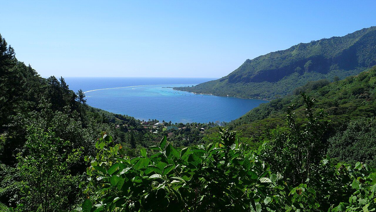
Opunohu Bay is longer, emptier and, for many visitors, the more beautiful. The road runs along its eastern shore with almost no buildings between you and the water. Mount Rotui forms one wall of the bay; on the other side the hills fold back towards the high peaks of the interior. Fishing boats come and go, and the shallows near the mouth turn bright where the reef begins.
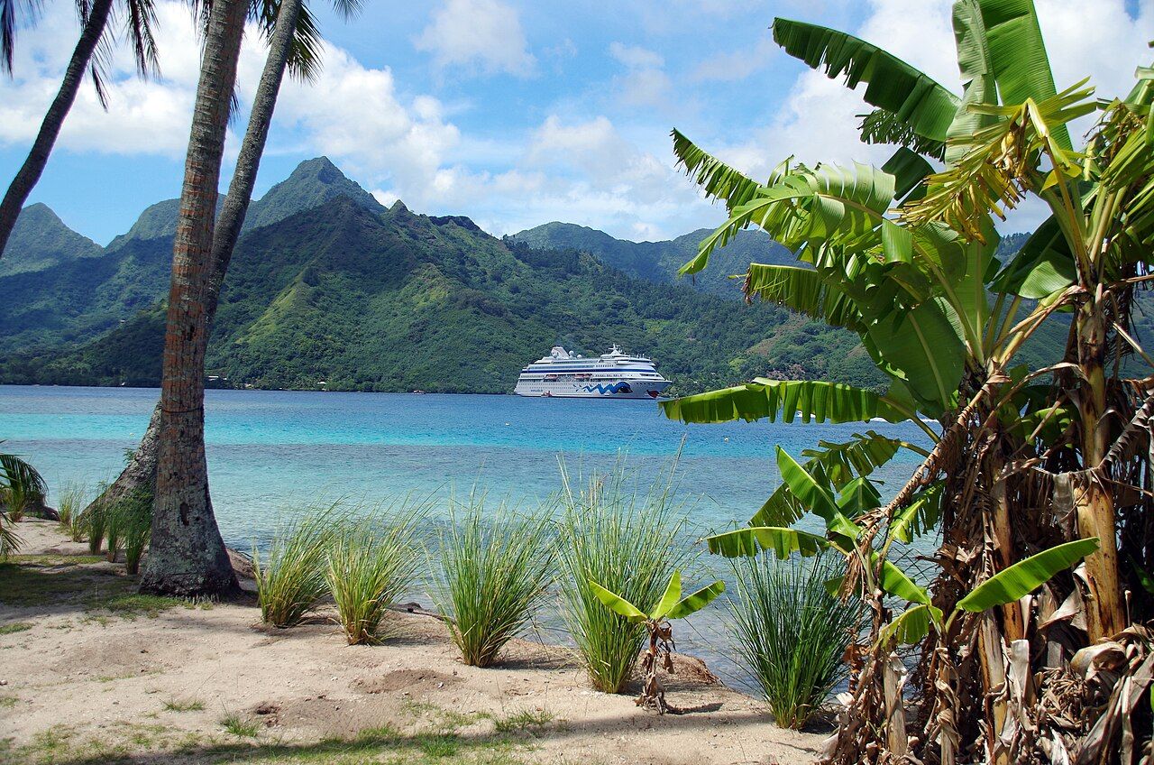
There is a small public beach near the mouth of the bay where families swim at weekends. Bring your own lunch, because there is little to buy along this shore. A good picnic here might be a loaf of bread from the morning, a ripe pineapple, a tin of tuna or a portion of poisson cru (raw fish in lime and coconut milk) bought cold in the morning and kept on ice. Raw fish needs to stay cold: if you cannot keep it chilled, eat it within the hour or choose something cooked. The guide to poisson cru covers what to look for.
Mount Rotui forms one wall of the bay; on the other side the hills fold back towards the high peaks of the interior.
Up the Opunohu valley through the pineapple fields
From the head of Opunohu Bay a road turns inland and climbs the valley. Within minutes the sea disappears behind you and the slopes open out into fields of low, spiky pineapple plants in long rows, with mango, breadfruit and coconut trees along the edges. Much of this land belongs to an agricultural school, and the valley has long been the island's main growing area for the small, sweet pineapples Moorea is known for. The story of Moorea's pineapples goes deeper into the fields and the fruit.
Also on the menuThe small, sweet pineapples of the valleys
The road keeps climbing through forest. Higher up you reach the marae of the Opunohu valley: stone platforms and enclosures once used for worship, community gatherings and archery contests among the island's chiefs. Some are close to the road, others along short paths under tall Tahitian chestnut trees, whose roots grip the old stones. Walk around the edges and stay off the platforms themselves, which remain sacred sites. Information boards explain the different kinds of structure in general terms.
The Belvedere lookout
The road ends at the Belvedere, a viewpoint on a saddle below the island's central peaks. From here both bays lie spread out below you, one on each side of Mount Rotui, with the lagoon and the reef beyond them and, on a clear day, open ocean to the horizon. It is the view on half the postcards of Moorea, and it earns that place.
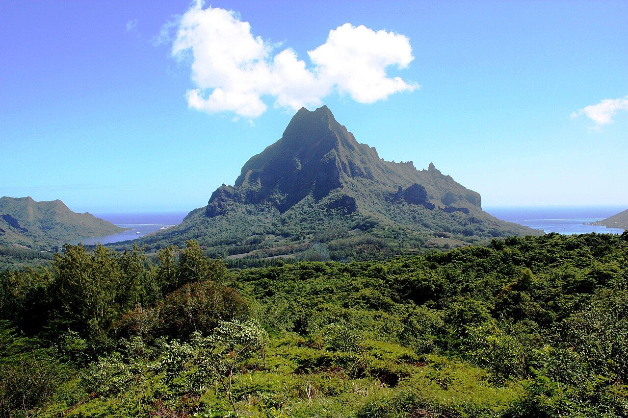
Arrive early in the morning if you can. Cloud often gathers on the peaks as the day warms, and by midday the view can vanish for an hour at a time. There is parking, and usually someone selling cold drinks or fruit, but do not count on it. Bring water, a sun hat and insect repellent, because mosquitoes like the shade of the car park.
Several walking trails start near the lookout, including the route over the Three Coconuts pass. They are muddy after rain and steep in places, and the forest is hot and humid even in the cooler months. The page on Magic Mountain and the hiking trails covers what to expect on foot.
Planning a day around the bays
A simple plan works well. Drive or cycle the shore of Cook's Bay in the early morning, buy fruit and bread as you go, then cross the base of Mount Rotui to Opunohu Bay. Climb the valley road while the air is still clear, stop at the marae on the way up or down, and spend an hour at the Belvedere. Come back down for a swim at the beach near the mouth of Opunohu Bay and an unhurried lunch in the shade.
A car or scooter makes this easy; the valley road is steep for bicycles, though strong riders manage it. Taxis exist but are expensive, and costs on Moorea in general are high, so check before you go and carry some cash for roadside stands. If you are planning the rest of the island, the drive round Moorea links these bays with the beaches, villages and churches of the other coasts.
The rhythm of this corner of Moorea rewards patience. Clouds move off the peaks, the water changes colour as the sun climbs, and the best fruit appears on the stands without warning. Leave room in the day for an extra stop.